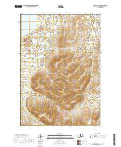
2019 Map of Russian Mission B-3 SE
USGS Topo · Published 2019About this map
Whitefish Lake dominates the northwestern corner of this landscape in the Bethel Census Area, serving as a primary hydrological feature in an area defined by extensive wetlands and complex drainage patterns. The terrain transitions from the low-lying aquatic margins of the lake into a more elevated southern interior, where the waters of Ophir Cr flow through the southwestern reaches. The presence of these named water bodies amidst a dense network of unnamed ponds and marshes highlights the specific landmarks used for navigation and resource identification in this part of Alaska. Mapping by the U.S. Geological Survey illustrates the township and range divisions, such as t14n r59w, which overlay a territory largely shaped by the natural movement of water and glacial contours rather than permanent infrastructure or roads.
Find a feature on this map
8 named features on this map. Tap any name to fly to it.
Don’t see what you’re looking for? This feature index may not catch every label — zoom into the map to look around manually.
Map Details
Editions of this 2019 Russian Mission B-3 SE Map
This is the sole edition of this map. No revisions or reprints were ever made.
Other maps of this area

1947 · Russian Mission
USGS Topo · 1:250,000

1950 · Russian Mission
USGS Topo · 1:250,000

1952 · Russian Mission B-2
USGS Topo · 1:63,360

1952 · Russian Mission B-3
USGS Topo · 1:63,360

1954 · Russian Mission A-3
USGS Topo · 1:63,360

1979 · Russian Mission A-2
USGS Topo · 1:63,360

1980 · Russian Mission
USGS Topo · 1:250,000
2019 · Russian Mission A-3 NW
USGS Topo · 1:25,000
2019 · Russian Mission B-3 SW
USGS Topo · 1:25,000
2019 · Russian Mission B-3 NE
USGS Topo · 1:25,000