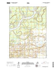
2017 Map of Russian Mission B-4 NW
USGS Topo · Published 2017About this map
The Kuskokwim River dominates this landscape in the Bethel Census Area, where its massive alluvial floodplain creates a complex network of shifting channels and islands. This 2017 survey illustrates the intricate braided nature of the waterway as it moves through the tundra, fed by tributaries including Mud Creek and Discovery Creek. The lack of road infrastructure and formal settlements in this specific quadrangle emphasizes the reliance on these river systems for transportation and seasonal subsistence. The map provides a detailed view of the wetland patterns and low-lying topography that characterize this part of the Yukon-Kuskokwim Delta, where the river's path is defined by constant erosion and deposition.
Find a feature on this map
7 named features on this map. Tap any name to fly to it.
Don’t see what you’re looking for? This feature index may not catch every label — zoom into the map to look around manually.
Map Details
Editions of this 2017 Russian Mission B-4 NW Map
This is the sole edition of this map. No revisions or reprints were ever made.
Other maps of this area

1947 · Russian Mission
USGS Topo · 1:250,000

1950 · Russian Mission
USGS Topo · 1:250,000

1952 · Russian Mission C-5
USGS Topo · 1:63,360

1954 · Russian Mission B-5
USGS Topo · 1:63,360

1954 · Russian Mission C-4
USGS Topo · 1:63,360

1954 · Russian Mission B-4
USGS Topo · 1:63,360

1980 · Russian Mission
USGS Topo · 1:250,000
2017 · Russian Mission C-5 SE
USGS Topo · 1:25,000
2017 · Russian Mission B-4 NE
USGS Topo · 1:25,000
2017 · Russian Mission C-4 SE
USGS Topo · 1:25,000