
1954 Map of Russian Mission B-5
USGS Topo · Published 1962About this map
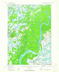
The Kuskokwim River dominates this landscape, its braided channels and intricate oxbow lakes defining the central geography of the region. In the early 1950s, the settlement of Uknavik sits along the river's edge, serving as a primary point of human activity within this complex hydrologic network. The map reveals the vital importance of seasonal transit, highlighted by the Winter Trail which parallels the main river corridor and provides access to a lonely Shelter cabin further south.
Find a feature on this map
7 named features on this map. Tap any name to fly to it.
Don’t see what you’re looking for? This feature index may not catch every label — zoom into the map to look around manually.
Map Details
Editions of this 1954 Russian Mission B-5 Map
2 editions found
Other maps of this area

1947 · Russian Mission
USGS Topo · 1:250,000

1950 · Russian Mission
USGS Topo · 1:250,000

1952 · Russian Mission C-5
USGS Topo · 1:63,360
1952 · Russian Mission B-6
USGS Topo · 1:63,360
1952 · Russian Mission C-6
USGS Topo · 1:63,360

1954 · Russian Mission A-4
USGS Topo · 1:63,360

1954 · Russian Mission A-6
USGS Topo · 1:63,360

1954 · Russian Mission A-5
USGS Topo · 1:63,360

1954 · Russian Mission C-4
USGS Topo · 1:63,360

1954 · Russian Mission B-4
USGS Topo · 1:63,360