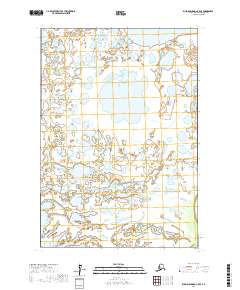
2017 Map of Russian Mission C-5 SE
USGS Topo · Published 2017About this map
The labyrinthine wetlands of the Johnson River delta characterize this portion of the Bethel Census Area, where water and land merge into a complex hydrological network. Significant water bodies such as Kukaklik Lake and the Portage Lakes dominate the northern terrain, connected by unnamed sloughs and seasonal drainages. Further south, the meandering path of Crooked Cr and the flow of Mud Creek illustrate the low-lying, sedimentary nature of the Alaskan tundra. This map provides an essential baseline for understanding the shifting shorelines and drainage patterns of the Yukon-Kuskokwim Delta region, a landscape where the lack of roads or permanent settlements emphasizes the dominance of the natural environment and the importance of traditional river corridors for navigation.
Find a feature on this map
11 named features on this map. Tap any name to fly to it.
Don’t see what you’re looking for? This feature index may not catch every label — zoom into the map to look around manually.
Map Details
Editions of this 2017 Russian Mission C-5 SE Map
This is the sole edition of this map. No revisions or reprints were ever made.
Other maps of this area

1947 · Russian Mission
USGS Topo · 1:250,000

1950 · Russian Mission
USGS Topo · 1:250,000

1952 · Russian Mission C-5
USGS Topo · 1:63,360

1954 · Russian Mission B-5
USGS Topo · 1:63,360

1954 · Russian Mission C-4
USGS Topo · 1:63,360

1954 · Russian Mission B-4
USGS Topo · 1:63,360

1980 · Russian Mission
USGS Topo · 1:250,000
2017 · Russian Mission C-5 SW
USGS Topo · 1:25,000
2017 · Russian Mission C-5 NW
USGS Topo · 1:25,000
2017 · Russian Mission C-5 NE
USGS Topo · 1:25,000