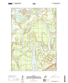
2017 Map of Russian Mission B-5 NE
USGS Topo · Published 2017About this map
The Kuskokwim River dominates this landscape in the Bethel Census Area, winding through an intricate network of wetlands and seasonal sloughs. This 2017 survey shows the river's path as it meanders through several townships, including t16n r63w and t15n r63w. The map illustrates a highly dynamic riparian environment where the primary waterway breaks into secondary channels, creating numerous islands and sandbars. Such a detailed study of the river's hydrology is essential for understanding the seasonal changes and transportation routes in this part of Alaska, where the water itself is the primary highway between points in the interior.
Find a feature on this map
5 named features on this map. Tap any name to fly to it.
Don’t see what you’re looking for? This feature index may not catch every label — zoom into the map to look around manually.
Map Details
Editions of this 2017 Russian Mission B-5 NE Map
This is the sole edition of this map. No revisions or reprints were ever made.
Other maps of this area

1947 · Russian Mission
USGS Topo · 1:250,000

1950 · Russian Mission
USGS Topo · 1:250,000

1952 · Russian Mission C-5
USGS Topo · 1:63,360

1954 · Russian Mission B-5
USGS Topo · 1:63,360

1954 · Russian Mission C-4
USGS Topo · 1:63,360

1954 · Russian Mission B-4
USGS Topo · 1:63,360

1980 · Russian Mission
USGS Topo · 1:250,000
2017 · Russian Mission C-5 SW
USGS Topo · 1:25,000
2017 · Russian Mission C-5 SE
USGS Topo · 1:25,000
2017 · Russian Mission B-5 NW
USGS Topo · 1:25,000