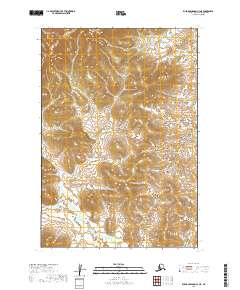
2019 Map of Russian Mission C-3 NE
USGS Topo · Published 2019About this map
The low-lying wetlands and complex topography of the Bethel Census Area are documented in this 2019 survey of the Russian Mission C-3 NE quadrangle. This landscape is defined by the intersection of four township and range blocks: T19n R59w, T19n R58w, T18n R59w, and T18n R58w. The terrain shows a distinct transition from the elevated contours in the northwest to the dense network of small water bodies and marshlands that dominate the eastern and southern portions of the sheet. Such a map is essential for understanding the natural drainage patterns and land division in this part of Alaska, where the lack of formal road infrastructure places a premium on the mapping of hydrography and elevation for navigation and regional planning.
Find a feature on this map
4 named features on this map. Tap any name to fly to it.
Don’t see what you’re looking for? This feature index may not catch every label — zoom into the map to look around manually.
Map Details
Editions of this 2019 Russian Mission C-3 NE Map
This is the sole edition of this map. No revisions or reprints were ever made.
Other maps of this area

1947 · Russian Mission
USGS Topo · 1:250,000

1950 · Russian Mission
USGS Topo · 1:250,000

1952 · Russian Mission D-2
USGS Topo · 1:63,360

1952 · Russian Mission D-3
USGS Topo · 1:63,360

1952 · Russian Mission C-3
USGS Topo · 1:63,360

1952 · Russian Mission C-2
USGS Topo · 1:63,360

1980 · Russian Mission
USGS Topo · 1:250,000
2019 · Russian Mission C-3 NW
USGS Topo · 1:25,000
2019 · Russian Mission C-3 SW
USGS Topo · 1:25,000
2019 · Russian Mission D-3 SW
USGS Topo · 1:25,000