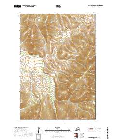
2019 Map of Russian Mission D-1 SE
USGS Topo · Published 2019About this map
Owhat River and Cobalt Cr wind through this remote interior landscape, shaping the drainage patterns of the western Kuskokwim Mountains area. The terrain is characterized by complex hydrology and wetland systems, with the Iditarod River clipping the northeast corner of the sheet. This 2019 survey documents the intricate topographic contours and township boundaries within the Bethel Census Area, providing a contemporary record of the land prior to modern shifts in river channels or vegetation. While devoid of named settlements, the map illustrates the primary waterways that have historically served as the essential travel corridors for indigenous people and later explorers traversing this portion of the Alaska wilderness.
Find a feature on this map
9 named features on this map. Tap any name to fly to it.
Don’t see what you’re looking for? This feature index may not catch every label — zoom into the map to look around manually.
Map Details
Editions of this 2019 Russian Mission D-1 SE Map
This is the sole edition of this map. No revisions or reprints were ever made.
Other maps of this area

1947 · Russian Mission
USGS Topo · 1:250,000

1950 · Russian Mission
USGS Topo · 1:250,000

1950 · Sleetmute
USGS Topo · 1:250,000

1952 · Russian Mission C-1
USGS Topo · 1:63,360

1952 · Russian Mission D-1
USGS Topo · 1:63,360
1954 · Sleetmute C-8
USGS Topo · 1:63,360
1954 · Sleetmute D-8
USGS Topo · 1:63,360

1954 · Sleetmute
USGS Topo · 1:250,000

1980 · Russian Mission
USGS Topo · 1:250,000
2019 · Sleetmute D-8 NW
USGS Topo · 1:25,000