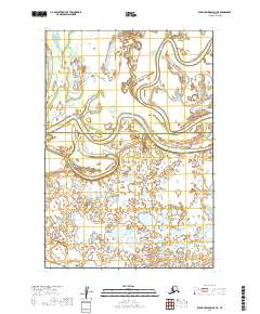
2019 Map of Russian Mission D-3 NE
USGS Topo · Published 2019About this map
Paimiut Slough dominates this landscape, winding in tight oxbows and expansive loops through the marshy interior of western Alaska. The terrain is characterized by a complex network of wetlands, small ponds, and alluvial features typical of the region's riverine floodplains. This 2019 survey documents the administrative boundary between the Yukon-Koyukuk Census Area and the Bethel Census Area, which runs east-to-west across the center of the sheet. The map provides a detailed view of the natural hydrology in an area defined by shifting watercourses rather than permanent roads or settlements. It serves as a precise record of the public land survey system divisions, including portions of township T22N R58W and T21N R57W, illustrating the intersection of remote geographic features and formal jurisdictional lines.
Find a feature on this map
6 named features on this map. Tap any name to fly to it.
Don’t see what you’re looking for? This feature index may not catch every label — zoom into the map to look around manually.
Map Details
Editions of this 2019 Russian Mission D-3 NE Map
This is the sole edition of this map. No revisions or reprints were ever made.
Other maps of this area

1947 · Russian Mission
USGS Topo · 1:250,000

1950 · Russian Mission
USGS Topo · 1:250,000

1951 · Holy Cross
USGS Topo · 1:250,000

1952 · Holy Cross A-2
USGS Topo · 1:63,360

1952 · Russian Mission D-2
USGS Topo · 1:63,360

1952 · Holy Cross
USGS Topo · 1:250,000

1952 · Russian Mission D-3
USGS Topo · 1:63,360

1980 · Russian Mission
USGS Topo · 1:250,000
2019 · Russian Mission D-2 NW
USGS Topo · 1:25,000
2019 · Russian Mission D-3 SW
USGS Topo · 1:25,000