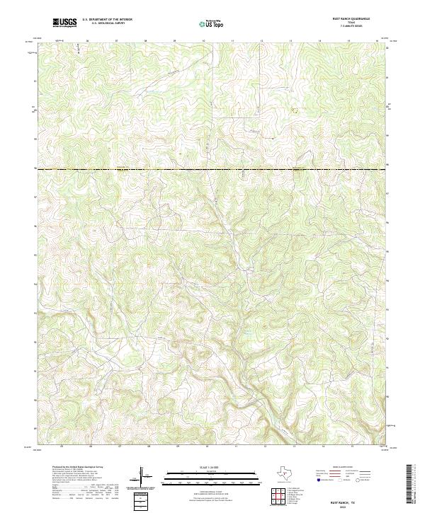
2022 Map of Rust Ranch
USGS Topo · Published 2022About this map
The Menard Co and Kimble Co line divides this stretch of the Texas Hill Country, where the landscape is defined by the ephemeral drainages of the Edwards Plateau. The hydrology here is dominated by seasonal draws and creeks, including the westward-flowing W Las Moras Cr and the branching network of W Bear Cr. A key landmark is Gentry Springs, a vital water source in this semi-arid environment. The road network consists primarily of rural county routes and ranch roads, such as Co RD 210 and Bannowsky Rd, which connect isolated ranching operations. The presence of named tracks like Williamson Rd and Rust Rd reflects the long-standing family landholdings that have shaped the local geography and land use patterns since the early days of settlement in the western Llano River basin.
Find a feature on this map
16 named features on this map. Tap any name to fly to it.
Don’t see what you’re looking for? This feature index may not catch every label — zoom into the map to look around manually.
Map Details
Editions of this 2022 Rust Ranch Map
This is the sole edition of this map. No revisions or reprints were ever made.
Other maps of this area

1893 · Fort McKavett
USGS Topo · 1:125,000

1954 · Llano
USGS Topo · 1:250,000

1954 · Sonora
USGS Topo · 1:250,000

1955 · Llano
USGS Topo · 1:250,000

1956 · Llano
USGS Topo · 1:250,000

1958 · Sonora
USGS Topo · 1:250,000

1963 · McKegan Draw
USGS Topo · 1:24,000

1963 · McKegan Draw NE
USGS Topo · 1:24,000

1970 · San Augustine Draw
USGS Topo · 1:24,000

1970 · Julio Draw
USGS Topo · 1:24,000