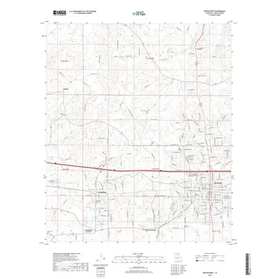
2018 Map of Ruston West
USGS Topo · Published 2018About this map
The educational corridor of North Louisiana centers this modern survey, where Grambling State Univ and Louisiana Tech Univ define the local landscape between the western edge of Ruston and the city of Grambling. The terrain is shaped by a dense network of creek drainages, including Wafer Cr, Cypress Cr, and Chautauqua Cr, which flow through the pine-covered hills of Lincoln Parish. Small historical settlements like Vienna and Antioch appear alongside several family-named burial grounds, such as Waldron Cem and Wilder Cem. The layout of Grambling is particularly detailed, showing the street grid from Adams Ave to Medgar Evers St. This contemporary digital survey highlights the continued significance of these university campuses as anchors for the region's growth and infrastructure.
Find a feature on this map
171 named features on this map. Tap any name to fly to it.
Don’t see what you’re looking for? This feature index may not catch every label — zoom into the map to look around manually.
Map Details
Editions of this 2018 Ruston West Map
This is the sole edition of this map. No revisions or reprints were ever made.
Other maps of this area

1947 · Bienville
USGS Topo · 1:62,500

1949 · Bienville
USGS Topo · 1:62,500

1950 · Ruston
USGS Topo · 1:62,500

1950 · Arcadia
USGS Topo · 1:62,500

1951 · Arcadia
USGS Topo · 1:62,500

1951 · Ruston
USGS Topo · 1:62,500

1953 · Hodge
USGS Topo · 1:62,500

1955 · Shreveport
USGS Topo · 1:250,000

1956 · Shreveport
USGS Topo · 1:250,000

1984 · Shreveport
USGS Topo · 1:250,000