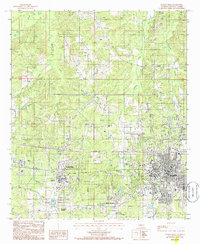
1985 Map of Ruston West
USGS Topo · Published 1986About this map
Grambling State University and Louisiana Tech University anchor this mid-1980s portrait of Lincoln Parish, showcasing a region defined by higher education and intersecting waterways. The map details the western expansion of Ruston, including the Ruston Municipal Airport and the transition from the city's structured streets to the surrounding woodland and creek valleys. Historically significant areas like Vienna in the north and the smaller settlement at Barnet reflect the rural community patterns that preceded modern suburban development.
Find a feature on this map
21 named features on this map. Tap any name to fly to it.
Don’t see what you’re looking for? This feature index may not catch every label — zoom into the map to look around manually.
Map Details
Editions of this 1985 Ruston West Map
This is the sole edition of this map. No revisions or reprints were ever made.
Other maps of this area

1947 · Bienville
USGS Topo · 1:62,500

1949 · Bienville
USGS Topo · 1:62,500

1950 · Ruston
USGS Topo · 1:62,500

1950 · Arcadia
USGS Topo · 1:62,500

1951 · Arcadia
USGS Topo · 1:62,500

1951 · Ruston
USGS Topo · 1:62,500

1953 · Hodge
USGS Topo · 1:62,500

1955 · Shreveport
USGS Topo · 1:250,000

1956 · Shreveport
USGS Topo · 1:250,000

1984 · Shreveport
USGS Topo · 1:250,000