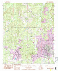
1994 Map of Ruston West
USGS Topo · Published 1995About this map
Grambling State University and Louisiana Tech University anchor this portion of Lincoln Parish, illustrating the educational and residential expansion occurring in North Louisiana during the late 20th century. The transition from the rural landscape to urban centers is clear, as the map records the growth of Ruston and Grambling alongside older settlements like Vienna and Barnet. Purple revision overlays from a 1994 update highlight the rapid development of local infrastructure, particularly around Grambling Corners and the Ruston Municipal Airport.
Find a feature on this map
21 named features on this map. Tap any name to fly to it.
Don’t see what you’re looking for? This feature index may not catch every label — zoom into the map to look around manually.
Map Details
Editions of this 1994 Ruston West Map
This is the sole edition of this map. No revisions or reprints were ever made.
Other maps of this area

1947 · Bienville
USGS Topo · 1:62,500

1949 · Bienville
USGS Topo · 1:62,500

1950 · Ruston
USGS Topo · 1:62,500

1950 · Arcadia
USGS Topo · 1:62,500

1951 · Arcadia
USGS Topo · 1:62,500

1951 · Ruston
USGS Topo · 1:62,500

1953 · Hodge
USGS Topo · 1:62,500

1955 · Shreveport
USGS Topo · 1:250,000

1956 · Shreveport
USGS Topo · 1:250,000

1984 · Shreveport
USGS Topo · 1:250,000