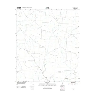
2012 Map of Ruth
USGS Topo · Published 2012About this map
Ruth serves as the central hub of this South Mississippi landscape, where a dense network of local roads such as China Grove Dr SE and Pleasant Grove Rd SE connect small rural communities. The terrain is defined by the branching tributaries of the Topisaw, including W Topisaw Cr and E Topisaw Cr, which create a complex drainage pattern across the quadrangle. A notable concentration of family-named cemeteries, including Brister Cem, Moak Cem, and Rawls Cem, suggests a deeply rooted local genealogy and long-standing land ownership patterns. The presence of the Ruth Lookout Tower north of Bristerville highlights the area's historical management of its timber resources, while small settlements like East Lincoln and Wellman anchor the northern reaches of the survey.
Find a feature on this map
75 named features on this map. Tap any name to fly to it.
Don’t see what you’re looking for? This feature index may not catch every label — zoom into the map to look around manually.
Map Details
Editions of this 2012 Ruth Map
This is the sole edition of this map. No revisions or reprints were ever made.
Other maps of this area

1953 · Natchez
USGS Topo · 1:250,000

1956 · Natchez
USGS Topo · 1:250,000

1959 · Natchez
USGS Topo · 1:250,000

1970 · Topeka
USGS Topo · 1:24,000

1970 · Jayess
USGS Topo · 1:24,000

1970 · Nola
USGS Topo · 1:24,000

1972 · Fair Oak Springs
USGS Topo · 1:24,000

1972 · Ruth
USGS Topo · 1:24,000

1972 · Pricedale
USGS Topo · 1:24,000

1972 · Bogue Chitto
USGS Topo · 1:24,000