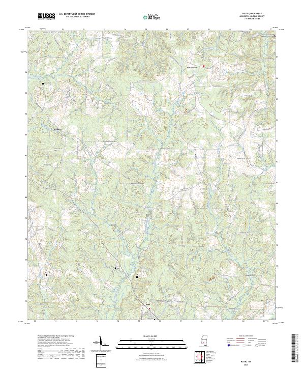
2024 Map of Ruth
USGS Topo · Published 2024About this map
East Lincoln and the surrounding rural landscapes of Lincoln County are defined by a network of small creeks and family cemeteries that anchor the local heritage. The terrain is deeply carved by the West Topisaw Creek and East Topisaw Creek, creating a drainage pattern that has historically shaped the placement of roads and homesteads. Small community centers like Wellman and Ruth serve as focal points for this agricultural region, where the road network often follows the ridges between the numerous branches and creeks.
Find a feature on this map
81 named features on this map. Tap any name to fly to it.
Don’t see what you’re looking for? This feature index may not catch every label — zoom into the map to look around manually.
Map Details
Editions of this 2024 Ruth Map
This is the sole edition of this map. No revisions or reprints were ever made.
Other maps of this area

1953 · Natchez
USGS Topo · 1:250,000

1956 · Natchez
USGS Topo · 1:250,000

1959 · Natchez
USGS Topo · 1:250,000

1970 · Topeka
USGS Topo · 1:24,000

1970 · Jayess
USGS Topo · 1:24,000

1970 · Nola
USGS Topo · 1:24,000

1972 · Fair Oak Springs
USGS Topo · 1:24,000

1972 · Ruth
USGS Topo · 1:24,000

1972 · Pricedale
USGS Topo · 1:24,000

1972 · Bogue Chitto
USGS Topo · 1:24,000