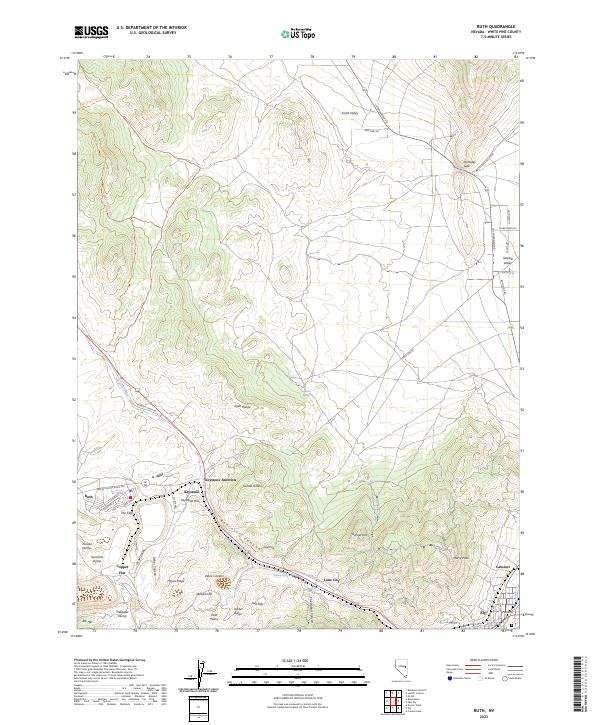
2023 Map of Ruth
USGS Topo · Published 2023About this map
Ruth sits at the heart of this landscape, dominated by the industrial legacy of Copper Flat and several prominent mining refuse sites like Sunshine Dump and Puritan Dump. The terrain is defined by the steep grades of the Egan Range, rising to high points at Murry Peak and Elijah Hill. This high-desert environment shows a clear divide between the industrial activity near the Robinson Canyon and the surrounding open territory of Smith Valley and Steptoe Valley. Local transportation centers on Gleason Creek Rd and Lackawanna Rd, which connect the small mining communities of Keystone, Lane City, and Calumet to the larger hub of Ely in the southeast corner. The presence of the Bristlecone Wilderness at the northern edge provides a sharp contrast to the nearby excavated earth and ridges like Jupiter Ridge and Hayes Ridge.
Find a feature on this map
66 named features on this map. Tap any name to fly to it.
Don’t see what you’re looking for? This feature index may not catch every label — zoom into the map to look around manually.
Map Details
Editions of this 2023 Ruth Map
This is the sole edition of this map. No revisions or reprints were ever made.
Other maps of this area

1952 · Ely
USGS Topo · 1:125,000

1956 · Ely
USGS Topo · 1:250,000

1958 · McGill
USGS Topo · 1:24,000

1958 · Ruth
USGS Topo · 1:24,000

1958 · East Ely
USGS Topo · 1:24,000

1958 · Comins Lake
USGS Topo · 1:24,000

1958 · Ely
USGS Topo · 1:62,500

1958 · McGill
USGS Topo · 1:62,500

1958 · Reipetown
USGS Topo · 1:24,000

1958 · Giroux Wash
USGS Topo · 1:24,000