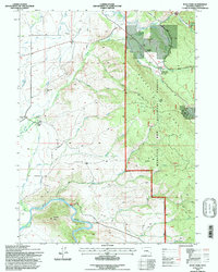
1992 Map of Ryan Park
USGS Topo · Published 1998About this map
Medicine Bow National Forest dominates this topographic study of south-central Wyoming, where the high-altitude landscape is carved by a complex network of waterways including North Brush Creek, South Brush Creek, and the North Platte River. The settlement pattern reflects the area's transition from resource extraction and ranching toward recreation and forest management. Historical markers of the territory's past include the Dewey Mine in the north and family-held operations like Brush Creek Ranch and Condict Ranch.
Find a feature on this map
41 named features on this map. Tap any name to fly to it.
Don’t see what you’re looking for? This feature index may not catch every label — zoom into the map to look around manually.
Map Details
Editions of this 1992 Ryan Park Map
2 editions found
Other maps of this area

1906 · Medicine Bow
USGS Topo · 1:125,000

1908 · Medicine Bow
USGS Topo · 1:125,000

1939 · Saratoga
USGS Topo · 1:125,000

1954 · Rawlins
USGS Topo · 1:250,000

1958 · Rawlins
USGS Topo · 1:250,000

1961 · Overlook Hill
USGS Topo · 1:24,000

1961 · Ryan Park
USGS Topo · 1:24,000
1961 · Kennaday Peak
USGS Topo · 1:24,000
1961 · Finley Reservoir
USGS Topo · 1:24,000

1961 · Gunst Reservoir
USGS Topo · 1:24,000