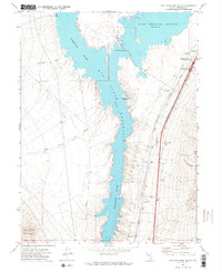
1971 Map of Rye Patch Reservoir South
USGS Topo · Published 1974About this map
The Humboldt River Rye Patch Reservoir and Lower Pitt-Taylor Reservoir dominate this Pershing County landscape, separated by the Pitt-Taylor Dam. This 1971 survey illustrates a desert environment defined by water management and transit corridors. The Southern Pacific railroad and Interstate 80 run parallel along the eastern shore, meeting the modern Humboldt Interchange near Humboldt House.
Find a feature on this map
22 named features on this map. Tap any name to fly to it.
Don’t see what you’re looking for? This feature index may not catch every label — zoom into the map to look around manually.
Map Details
Editions of this 1971 Rye Patch Reservoir South Map
2 editions found
Other maps of this area

1931 · Lovelock
USGS Topo · 1:250,000

1935 · Lovelock
USGS Topo · 1:250,000

1954 · Unionville
USGS Topo · 1:62,500

1955 · Lovelock
USGS Topo · 1:250,000

1956 · Oreana
USGS Topo · 1:62,500

1956 · Imlay
USGS Topo · 1:62,500

1959 · Lovelock
USGS Topo · 1:250,000

1971 · Majuba Mtn
USGS Topo · 1:24,000

1971 · Rye Patch Reservoir South
USGS Topo · 1:24,000

1971 · Poker Brown
USGS Topo · 1:24,000