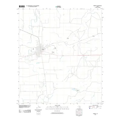
2010 Map of Sabinal
USGS Topo · Published 2010About this map
The Sabinal River and its numerous tributaries, including Elm Creek and Rancheros Creek, define the hydrological layout of this South Texas landscape. At the center of the survey lies the town of Sabinal, positioned at the junction of several regional routes and the east-west rail line. This 2010 documentation captures the town's spatial organization, showing the grid-patterned streets surrounded by expansive rural reaches and agricultural infrastructure.
Find a feature on this map
27 named features on this map. Tap any name to fly to it.
Don’t see what you’re looking for? This feature index may not catch every label — zoom into the map to look around manually.
Map Details
Editions of this 2010 Sabinal Map
This is the sole edition of this map. No revisions or reprints were ever made.
Other maps of this area

1898 · Uvalde
USGS Topo · 1:125,000

1899 · Uvalde
USGS Topo · 1:125,000

1928 · Frio Town
USGS Topo · 1:62,500

1954 · San Antonio
USGS Topo · 1:250,000

1956 · Sabinal
USGS Topo · 1:62,500

1957 · San Antonio
USGS Topo · 1:250,000

1969 · Sabinal NE
USGS Topo · 1:24,000

1969 · Comanche Waterhole
USGS Topo · 1:24,000
1969 · Trio
USGS Topo · 1:24,000
1970 · Irishman Hill
USGS Topo · 1:24,000