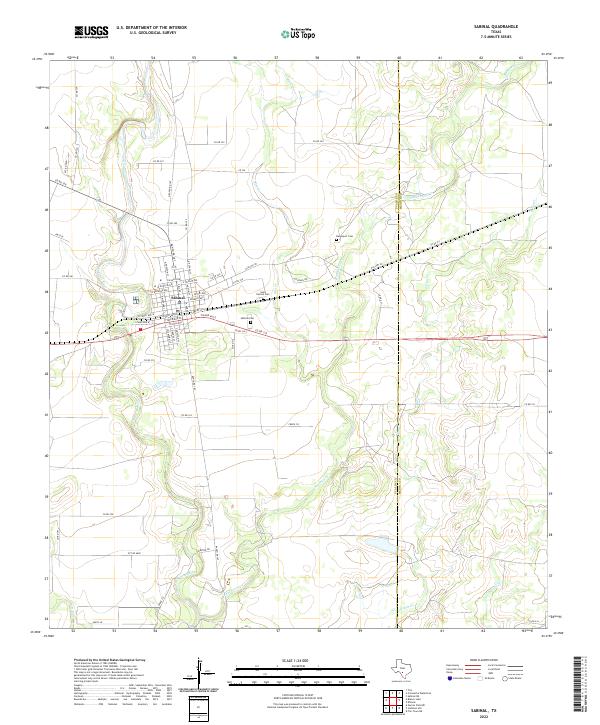
2022 Map of Sabinal
USGS Topo · Published 2022About this map
The town of Sabinal serves as the central hub of this Uvalde County landscape, situated at the junction of Ranch RD 187 and major east-west corridors. The community’s history is anchored by its local landmarks, including the Saint Patrick Cem, Sabinal Cem, and the more remote Davenport Cem to the northeast. The geography is defined by a series of parallel waterways that carve through the Texas brush country, most notably the meandering Sabinal River on the western edge and the various branches of Elm Cr, E Elm Cr, and Rancheros Cr further east.
Find a feature on this map
60 named features on this map. Tap any name to fly to it.
Don’t see what you’re looking for? This feature index may not catch every label — zoom into the map to look around manually.
Map Details
Editions of this 2022 Sabinal Map
This is the sole edition of this map. No revisions or reprints were ever made.
Other maps of this area

1898 · Uvalde
USGS Topo · 1:125,000

1899 · Uvalde
USGS Topo · 1:125,000

1928 · Frio Town
USGS Topo · 1:62,500

1954 · San Antonio
USGS Topo · 1:250,000

1956 · Sabinal
USGS Topo · 1:62,500

1957 · San Antonio
USGS Topo · 1:250,000

1969 · Sabinal NE
USGS Topo · 1:24,000

1969 · Comanche Waterhole
USGS Topo · 1:24,000
1969 · Trio
USGS Topo · 1:24,000
1970 · Irishman Hill
USGS Topo · 1:24,000