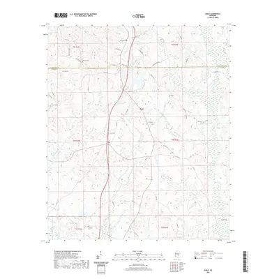
2020 Map of Sable
USGS Topo · Published 2020About this map
Sable and Roy anchor this topographic view of the rural landscape where the Lauderdale Co and Clarke Co lines meet in east-central Mississippi. The terrain is defined by a dense network of tributaries including Archusa Cr, Chinquapin Creek, and Moore Mill Cr, which carve through the wooded hillsides. This area remains largely rural and unincorporated, with the primary human footprint marked by a series of long-standing community landmarks. Genealogists and local historians will find several burial grounds documented, including Devoe Cem, Union Cem, and Oak Grove Cem. The map also captures the local hydrography at Patel Lake and the crossing at O'Neil Bridge, illustrating how the early road network, such as Beechwood Ridge and Clarkdale Rd, was dictated by the winding paths of Rolling Cr and Dry Cr.
Find a feature on this map
64 named features on this map. Tap any name to fly to it.
Don’t see what you’re looking for? This feature index may not catch every label — zoom into the map to look around manually.
Map Details
Editions of this 2020 Sable Map
This is the sole edition of this map. No revisions or reprints were ever made.
Other maps of this area

1921 · Meridian
USGS Topo · 1:48,000

1923 · Meridian
USGS Topo · 1:62,500

1953 · Meridian
USGS Topo · 1:250,000

1957 · Meridian
USGS Topo · 1:250,000

1957 · Chunky
USGS Topo · 1:62,500

1957 · Quitman
USGS Topo · 1:62,500

1957 · Enterprise
USGS Topo · 1:62,500

1965 · Meridian
USGS Topo · 1:250,000

1971 · Vimville
USGS Topo · 1:24,000

1971 · Meridian South
USGS Topo · 1:24,000