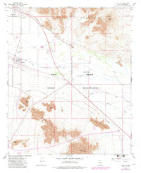
1966 Map of Sacaton
USGS Topo · Published 1982About this map
The Gila River Indian Reservation landscape is defined here by an intricate network of irrigation and infrastructure serving the Pinal County desert. The Gila River itself flows through the center of the sheet, flanked by the Santan Canal, Casa Blanca Canal, and Pima Lateral, illustrating the intensive water management required for the local settlements. The community of Sacaton serves as a focal point, featuring the Sacaton Cem and Pima Central Sch.
Find a feature on this map
32 named features on this map. Tap any name to fly to it.
Don’t see what you’re looking for? This feature index may not catch every label — zoom into the map to look around manually.
Map Details
Editions of this 1966 Sacaton Map
3 editions found
Other maps of this area

1907 · Sacaton
USGS Topo · 1:62,500

1914 · Gila Butte
USGS Topo · 1:62,500

1917 · Gila Butte
USGS Topo · 1:62,500

1922 · Casa Grande
USGS Topo · 1:62,500

1922 · Signal Peak
USGS Topo · 1:62,500

1924 · Signal Peak
USGS Topo · 1:62,500

1924 · Casa Grande
USGS Topo · 1:62,500

1952 · Gila Butte SE
USGS Topo · 1:24,000

1952 · Gila Butte
USGS Topo · 1:24,000

1952 · Gila Butte
USGS Topo · 1:62,500