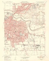
1949 Map of Sacramento East
USGS Topo · Published 1949About this map
The State Capitol and the surrounding urban grid of Sacramento define the western portion of this mid-century survey, revealing a city on the cusp of significant post-war expansion. The industrial and transportation infrastructure of the era is evident through the dense network of railroads, including the Southern Pacific and Sacramento Northern, which service the capital and nearby North Sacramento. Cultural and civic landmarks such as the State Fairgrounds, Edmonds Field, and the Sacramento Municipal Airport highlight the city's role as a regional hub.
Find a feature on this map
112 named features on this map. Tap any name to fly to it.
Don’t see what you’re looking for? This feature index may not catch every label — zoom into the map to look around manually.
Map Details
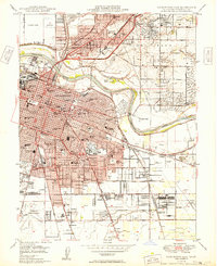
Editions of this 1949 Sacramento East Map
2 editions found
Other maps of this area

1891 · Sacramento
USGS Topo · 1:125,000

1892 · Sacramento
USGS Topo · 1:125,000

1893 · Sacramento
USGS Topo · 1:125,000

1894 · Lodi
USGS Topo · 1:125,000

1902 · Fairoaks
USGS Topo · 1:62,500

1907 · Davisville
USGS Topo · 1:62,500

1908 · Courtland
USGS Topo · 1:62,500

1909 · Elk Grove
USGS Topo · 1:31,680

1909 · Florin
USGS Topo · 1:31,680

1911 · Brighton
USGS Topo · 1:31,680