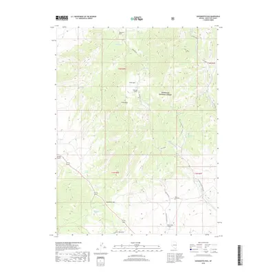
2018 Map of Sacramento Pass
USGS Topo · Published 2018About this map
The Snake Range dominates this portion of eastern Nevada, where high-elevation drainage systems like Silver Creek and the Main Fork Silver Cr carve through the terrain of the Humboldt National Forest. This 2018 survey documents a landscape defined by its vital water sources, including Chokecherry Spring, Rabbit Brush Spring, and Sacramento Springs. These springs supported early transit and settlement patterns in an otherwise arid environment.
Find a feature on this map
40 named features on this map. Tap any name to fly to it.
Don’t see what you’re looking for? This feature index may not catch every label — zoom into the map to look around manually.
Map Details
Editions of this 2018 Sacramento Pass Map
This is the sole edition of this map. No revisions or reprints were ever made.
Other maps of this area

1956 · Ely
USGS Topo · 1:250,000

1959 · Ely
USGS Topo · 1:250,000

1959 · Sacramento Pass
USGS Topo · 1:62,500

1963 · Ely
USGS Topo · 1:250,000
1986 · Mount Moriah
USGS Topo · 1:24,000
1986 · Yelland Dry Lake
USGS Topo · 1:24,000
1986 · Sixmile Canyon
USGS Topo · 1:24,000
1986 · Lehman Caves
USGS Topo · 1:24,000
1986 · Old Mans Canyon
USGS Topo · 1:24,000
1986 · South Bastian Spring
USGS Topo · 1:24,000