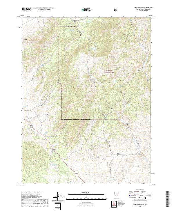
2021 Map of Sacramento Pass
USGS Topo · Published 2021About this map
Sacramento Pass serves as a critical geographic transition in the southern reaches of the Snake Range, where the terrain drops into a network of rugged canyons and seasonal washes. This high-altitude landscape is characterized by its numerous water sources, including Sacramento Springs and Turnley Spring, which likely dictated early routes through the mountains. Much of the northeast corner is protected within the Humboldt National Forest, where a system of trails like the Silver Creek Trl and Main Fork Silver Creek Trl provide access to the higher elevations.
Find a feature on this map
39 named features on this map. Tap any name to fly to it.
Don’t see what you’re looking for? This feature index may not catch every label — zoom into the map to look around manually.
Map Details
Editions of this 2021 Sacramento Pass Map
This is the sole edition of this map. No revisions or reprints were ever made.
Other maps of this area

1956 · Ely
USGS Topo · 1:250,000

1959 · Ely
USGS Topo · 1:250,000

1959 · Sacramento Pass
USGS Topo · 1:62,500

1963 · Ely
USGS Topo · 1:250,000
1986 · Mount Moriah
USGS Topo · 1:24,000
1986 · Yelland Dry Lake
USGS Topo · 1:24,000
1986 · Sixmile Canyon
USGS Topo · 1:24,000
1986 · Lehman Caves
USGS Topo · 1:24,000
1986 · Old Mans Canyon
USGS Topo · 1:24,000
1986 · South Bastian Spring
USGS Topo · 1:24,000