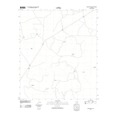
2010 Map of Saddle Butte
USGS Topo · Published 2010About this map
Saddle Butte and the broad plateau of Big Mesa define this high-desert ranching landscape in Pecos County during the early 21st century. The map reveals a sophisticated water-management infrastructure essential for survival in this arid terrain, marked by a network of named wind-powered wells. These include Canyon Windmill in the north, Windmill Number Three near the center, and the uniquely named Doodlebug Windmill to the south. Seasonal drainage is captured by features like Doodlebug Tank and directed through natural features such as Tunas Creek and Livingston Canyon. Access to these remote holdings is provided by a thin web of unpaved tracks, including Dagger Draw Rd, which branch off from the primary north-south highway corridor where the Highway Windmill serves as a landmark for travelers.
Find a feature on this map
14 named features on this map. Tap any name to fly to it.
Don’t see what you’re looking for? This feature index may not catch every label — zoom into the map to look around manually.
Map Details
Editions of this 2010 Saddle Butte Map
This is the sole edition of this map. No revisions or reprints were ever made.
Other maps of this area

1928 · Crane
USGS Topo · 1:125,000

1928 · Comanche Spring
USGS Topo · 1:125,000

1929 · Independence Draw Quadrangle
USGS Topo · 1:125,000

1954 · Pecos
USGS Topo · 1:250,000

1954 · Fort Stockton
USGS Topo · 1:250,000

1957 · Pecos
USGS Topo · 1:250,000

1958 · Fort Stockton
USGS Topo · 1:250,000

1969 · Bootleg Canyon
USGS Topo · 1:24,000

1969 · Skyscraper Peak
USGS Topo · 1:24,000

1970 · East Mesa
USGS Topo · 1:24,000