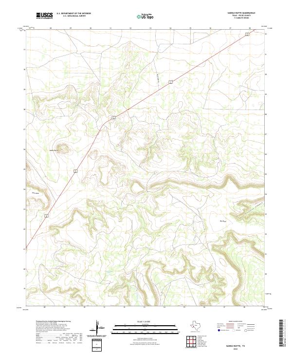
2022 Map of Saddle Butte
USGS Topo · Published 2022About this map
Saddle Butte and the surrounding high desert terrain dominate this part of Pecos County, where the landscape is defined by massive limestone structures and arid watercourses. The topography is marked by the broad expanses of East Mesa and Big Mesa, separated by deep incisions like Livingston Canyon. Human presence is sparse, dictated by the availability of water at features such as Doodlebug Tank and the seasonal flow of Tunas Cr. The map shows a region centered on infrastructure and ranching access, with the diagonal corridor of 67 385 providing the primary thoroughfare across the scrubland. Significant local routes like Dagger Draw Rd branch off into the interior, serving the remote basins and upland flats characteristic of this West Texas environment.
Find a feature on this map
8 named features on this map. Tap any name to fly to it.
Don’t see what you’re looking for? This feature index may not catch every label — zoom into the map to look around manually.
Map Details
Editions of this 2022 Saddle Butte Map
This is the sole edition of this map. No revisions or reprints were ever made.
Other maps of this area

1928 · Crane
USGS Topo · 1:125,000

1928 · Comanche Spring
USGS Topo · 1:125,000

1929 · Independence Draw Quadrangle
USGS Topo · 1:125,000

1954 · Pecos
USGS Topo · 1:250,000

1954 · Fort Stockton
USGS Topo · 1:250,000

1957 · Pecos
USGS Topo · 1:250,000

1958 · Fort Stockton
USGS Topo · 1:250,000

1969 · Bootleg Canyon
USGS Topo · 1:24,000

1969 · Skyscraper Peak
USGS Topo · 1:24,000

1970 · East Mesa
USGS Topo · 1:24,000