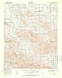
1950 Map of Saddle Mountain
USGS Topo · Published 1953About this map
Saddle Mountain and the surrounding Wichita Mountains dominate this mid-century landscape at the intersection of Kiowa, Caddo, and Comanche counties. The map documents a specialized pattern of settlement characterized by several historic missions, including the Cache Indian Mission, Saddle Mountain Indian Mission, and the Kiowa Mission further south. These sites, along with small community hubs like Alden and Meers, illustrate the cultural and educational network of the region through numerous country schools such as Victory Sch and Spring Valley Sch.
Find a feature on this map
63 named features on this map. Tap any name to fly to it.
Don’t see what you’re looking for? This feature index may not catch every label — zoom into the map to look around manually.
Map Details
Editions of this 1950 Saddle Mountain Map
2 editions found
Other maps of this area

1937 · Cache
USGS Topo · 1:48,000

1937 · Quanah Mountain
USGS Topo · 1:24,000

1942 · Cache
USGS Topo · 1:62,500

1946 · Lawton
USGS Topo · 1:62,500

1949 · Mount Scott
USGS Topo · 1:24,000

1949 · Cooperton
USGS Topo · 1:62,500

1949 · Quanah Mountain
USGS Topo · 1:24,000

1949 · Fort Sill
USGS Topo · 1:24,000

1950 · Snyder
USGS Topo · 1:62,500

1950 · Saddle Mountain
USGS Topo · 1:62,500