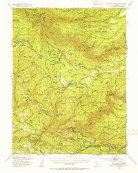
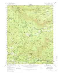
1950 Map of Saddle Mountain
USGS Topo · Published 1955About this map
Eldorado National Forest defines the topography of this mid-century survey, where the deep drainages of the North Fork American River and South Fork American River carve through the Sierra Nevada foothills. The landscape is a complex network of resource extraction and early mountain settlement, visible in the numerous mining operations such as the Kenna Mine and Pigeon Roost Mine. Evidence of early hydraulic engineering is everywhere, with a labyrinth of ditches, flumes, and pipelines feeding locations like the Surge Tank and various gaging stations.
Find a feature on this map
130 named features on this map. Tap any name to fly to it.
Don’t see what you’re looking for? This feature index may not catch every label — zoom into the map to look around manually.
Map Details
Editions of this 1950 Saddle Mountain Map
5 editions found
Other maps of this area

1889 · Pyramid Peak
USGS Topo · 1:125,000

1891 · Colfax
USGS Topo · 1:125,000

1891 · Truckee
USGS Topo · 1:125,000

1891 · Placerville
USGS Topo · 1:125,000

1891 · Pyramid Peak
USGS Topo · 1:125,000

1892 · Placerville
USGS Topo · 1:125,000

1892 · Colfax
USGS Topo · 1:125,000

1893 · Placerville
USGS Topo · 1:125,000

1893 · Truckee
USGS Topo · 1:125,000

1894 · Colfax
USGS Topo · 1:125,000