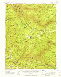
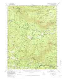
1950 Map of Saddle Mountain
USGS Topo · Published 1957About this map
Pollock Pines and the surrounding high country of the Eldorado National Forest define this mid-century survey of the California gold country. The landscape is a network of industrial and agricultural history, featuring legacy sites like the Kenna Mine, Bedrock Mine, and Tiedman Mine alongside the early water infrastructure of the South Fork Canal. Settlement patterns are recorded through family-named landmarks and outposts such as Bacchi Ranch, Connor Cabin, and Morton Ranch. The presence of the Mosquito District School and several dispersed cabins indicates a persistent rural community integrated into the timber and mining terrain. Significant topographic features like Saddle Mtn, Slate Mtn, and the Rubicon River underscore the area's complex drainage and elevation changes that dictated the path of the Michigan Bluff Railroad and the Georgetown Tunnel.
Find a feature on this map
63 named features on this map. Tap any name to fly to it.
Don’t see what you’re looking for? This feature index may not catch every label — zoom into the map to look around manually.
Map Details
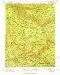
Editions of this 1950 Saddle Mountain Map
5 editions found
Other maps of this area

1889 · Pyramid Peak
USGS Topo · 1:125,000

1891 · Colfax
USGS Topo · 1:125,000

1891 · Truckee
USGS Topo · 1:125,000

1891 · Placerville
USGS Topo · 1:125,000

1891 · Pyramid Peak
USGS Topo · 1:125,000

1892 · Placerville
USGS Topo · 1:125,000

1892 · Colfax
USGS Topo · 1:125,000

1893 · Placerville
USGS Topo · 1:125,000

1893 · Truckee
USGS Topo · 1:125,000

1894 · Colfax
USGS Topo · 1:125,000