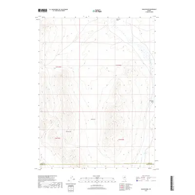
2018 Map of Sadler Basin
USGS Topo · Published 2018About this map
The Diamond Hills rise prominently along the western edge of this High Desert landscape, marking the rugged boundary where high ridges transition into the expansive Huntington Valley. This 2018 survey documents a remote section of Elko County where the high-altitude topography of the Diamond Hills creates a drainage system flowing eastward toward Huntington Cr. The presence of Franklin Spring in the southeast corner indicates a critical water source in this arid environment, a vital landmark for the ranching and livestock operations that have historically utilized these public lands. Centrally located, Sadler Basin provides a natural collection point for seasonal runoff, illustrating the complex hydrology of the Great Basin region. This map serves as an essential record of the county lines between Elko, Eureka, and White Pine counties, which intersect just south of the main terrain features.
Find a feature on this map
11 named features on this map. Tap any name to fly to it.
Don’t see what you’re looking for? This feature index may not catch every label — zoom into the map to look around manually.
Map Details
Editions of this 2018 Sadler Basin Map
This is the sole edition of this map. No revisions or reprints were ever made.
Other maps of this area

1934 · Jiggs
USGS Topo · 1:125,000

1937 · Jiggs
USGS Topo · 1:125,000

1955 · Elko
USGS Topo · 1:250,000

1956 · Robinson Mtn
USGS Topo · 1:62,500

1958 · Elko
USGS Topo · 1:250,000

1959 · Jiggs
USGS Topo · 1:62,500

1959 · Railroad Pass
USGS Topo · 1:62,500

1959 · Sherman Mtn
USGS Topo · 1:62,500

1962 · Elko
USGS Topo · 1:250,000

1965 · Elko
USGS Topo · 1:250,000