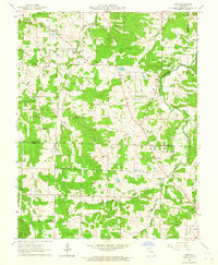
1962 Map of Safe
USGS Topo · Published 1964About this map
The Bourbeuse River snakes through the rolling terrain of eastern Maries and northern Phelps counties, serving as the central drainage for a landscape defined by small-scale agriculture and resource extraction. At the time of this 1962 survey, the rural character of the area is underscored by the presence of numerous family and community burial grounds, such as Rock Spring Cem, Underwood Cem, and Dillon Cem. The small settlement of Safe sits near the river's edge, while Light and the edge of St James anchor the southern and western portions of the quadrangle.
Find a feature on this map
30 named features on this map. Tap any name to fly to it.
Don’t see what you’re looking for? This feature index may not catch every label — zoom into the map to look around manually.
Map Details
Editions of this 1962 Safe Map
2 editions found
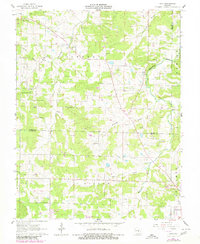
Other maps of this area

1912 · Rolla
USGS Topo · 1:62,500

1928 · Meramec Spring
USGS Topo · 1:62,500

1934 · Redbird
USGS Topo · 1:62,500

1937 · Vienna
USGS Topo · 1:62,500

1938 · Redbird
USGS Topo · 1:62,500

1938 · Vienna
USGS Topo · 1:48,000

1949 · Saint Louis
USGS Topo · 1:250,000

1949 · Vienna
USGS Topo · 1:62,500

1949 · Rolla
USGS Topo · 1:250,000

1949 · Meramec Spring
USGS Topo · 1:62,500