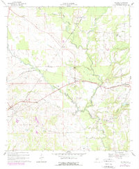
1968 Map of Safford
USGS Topo · Published 1979About this map
The agricultural landscape of Dallas County is defined by the winding course of Bogue Chitto Creek and its many tributaries, such as Caine Creek and Bear Creek. In the late 1960s, this region remained a hub of rural community life, anchored by numerous small congregations like St Johns Cem Ch, New Hope Ch, and Rising Star Ch. The rail infrastructure of the Southern and Louisville and Nashville lines provided the essential skeleton for commerce, connecting established stops at Safford, Martin, and Orrville. Notable for its many groundwater features, the area is dotted with labels for Flowing Well, suggesting the importance of the local aquifer to the surrounding farmsteads. From the cluster of activity at Martin Station to the isolated gravel pits and timbered wetlands, the map captures a period of transition where traditional land use patterns persisted alongside modernizing transportation corridors.
Find a feature on this map
38 named features on this map. Tap any name to fly to it.
Don’t see what you’re looking for? This feature index may not catch every label — zoom into the map to look around manually.
Map Details
Editions of this 1968 Safford Map
2 editions found
Other maps of this area

1953 · Montgomery
USGS Topo · 1:250,000

1956 · Montgomery
USGS Topo · 1:250,000

1957 · Montgomery
USGS Topo · 1:250,000

1957 · Carlowville
USGS Topo · 1:62,500

1958 · Selma
USGS Topo · 1:62,500

1968 · Uniontown East
USGS Topo · 1:24,000

1968 · Browns
USGS Topo · 1:24,000

1968 · Safford
USGS Topo · 1:24,000

1968 · Central Mills
USGS Topo · 1:24,000

1974 · Crumptonia
USGS Topo · 1:24,000