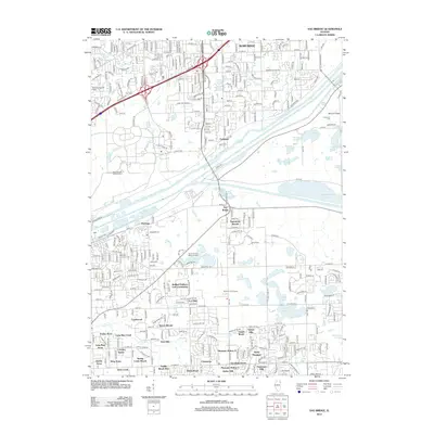
2012 Map of Sag Bridge
USGS Topo · Published 2012About this map
The Des Plaines River corridor and the parallel Illinois and Michigan Canal anchor this 2012 survey, illustrating a landscape defined by significant water management and suburban growth. The historic settlement of Sag Bridge sits near the crossing of these major waterways, while the northern reaches include the developed neighborhoods of Burr Ridge and Palisades. The region is notably abundant in forest preserves and wetlands, including the expansive Saganashkee Slough and Tampier Lake. Local history is preserved in numerous burial grounds such as Saint Patricks Catholic Cem and Cass Cem. South of the river, modern residential development is evident in communities like Ruffled Feathers Golf Community and Sylvan Woods, contrasting with the more industrial and transit-heavy infrastructure found along Joliet Rd and the local rail lines.
Find a feature on this map
69 named features on this map. Tap any name to fly to it.
Don’t see what you’re looking for? This feature index may not catch every label — zoom into the map to look around manually.
Map Details
Editions of this 2012 Sag Bridge Map
This is the sole edition of this map. No revisions or reprints were ever made.
Other maps of this area

1890 · Des Plaines
USGS Topo · 1:62,500

1891 · Riverside
USGS Topo · 1:62,500

1892 · Joliet
USGS Topo · 1:62,500

1893 · Riverside
USGS Topo · 1:62,500

1894 · Des Plaines
USGS Topo · 1:62,500

1900 · Des Plaines
USGS Topo · 1:62,500

1900 · Riverside
USGS Topo · 1:62,500

1901 · Des Plaines
USGS Topo · 1:62,500

1901 · Riverside
USGS Topo · 1:62,500

1908 · Wheaton
USGS Topo · 1:62,500