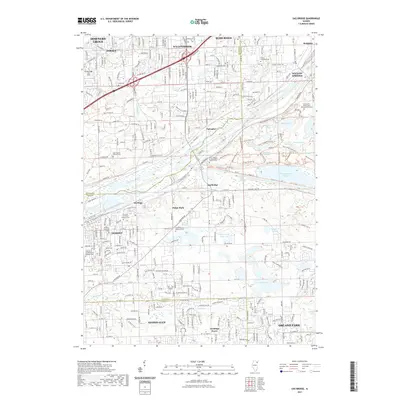
2021 Map of Sag Bridge
USGS Topo · Published 2021About this map
Lemont and the surrounding Chicago suburban corridor are defined by a complex network of industrial waterways and religious heritage. The landscape is dominated by the parallel courses of the Des Plaines River, the historic Illinois and Michigan Canal, and the Calumet Sag Channel, which together shaped the region's transport and industrial identity. Between these waterways and the rolling terrain of the Cook and Will County border lies a remarkable concentration of faith-based landmarks and cemeteries. Notable sites include the Saint James At Sag Bridge Catholic Cem and the Our Lady of Victory Convent Cem. To the east, the terrain gives way to a chain of wetlands and lakes, such as Saganashkee Slough and Tampier Lake, preserving a significant greenbelt amidst the expanding residential footprints of Orland Park and Homer Glen.
Find a feature on this map
156 named features on this map. Tap any name to fly to it.
Don’t see what you’re looking for? This feature index may not catch every label — zoom into the map to look around manually.
Map Details
Editions of this 2021 Sag Bridge Map
This is the sole edition of this map. No revisions or reprints were ever made.
Other maps of this area

1890 · Des Plaines
USGS Topo · 1:62,500

1891 · Riverside
USGS Topo · 1:62,500

1892 · Joliet
USGS Topo · 1:62,500

1893 · Riverside
USGS Topo · 1:62,500

1894 · Des Plaines
USGS Topo · 1:62,500

1900 · Des Plaines
USGS Topo · 1:62,500

1900 · Riverside
USGS Topo · 1:62,500

1901 · Des Plaines
USGS Topo · 1:62,500

1901 · Riverside
USGS Topo · 1:62,500

1908 · Wheaton
USGS Topo · 1:62,500