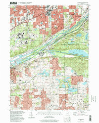
1997 Map of Sag Bridge
USGS Topo · Published 1999About this map
The confluence of heavy industrial infrastructure and extensive green space characterizes this 1990s landscape at the intersection of Cook, DuPage, and Will Counties. The massive Argonne National Laboratory Reservation dominates the western bluffs, while the central corridor is defined by the engineered waterways of the Chicago Sanitary and Ship Canal and the Calumet Sag Channel. These man-made arteries, flanked by the Atchison Topeka and Santa Fe Railway, illustrate the area's legacy as a vital Midwestern transportation and utility hub.
Find a feature on this map
53 named features on this map. Tap any name to fly to it.
Don’t see what you’re looking for? This feature index may not catch every label — zoom into the map to look around manually.
Map Details
Editions of this 1997 Sag Bridge Map
This is the sole edition of this map. No revisions or reprints were ever made.
Other maps of this area

1890 · Des Plaines
USGS Topo · 1:62,500

1891 · Riverside
USGS Topo · 1:62,500

1892 · Joliet
USGS Topo · 1:62,500

1893 · Riverside
USGS Topo · 1:62,500

1894 · Des Plaines
USGS Topo · 1:62,500

1900 · Des Plaines
USGS Topo · 1:62,500

1900 · Riverside
USGS Topo · 1:62,500

1901 · Des Plaines
USGS Topo · 1:62,500

1901 · Riverside
USGS Topo · 1:62,500

1908 · Wheaton
USGS Topo · 1:62,500