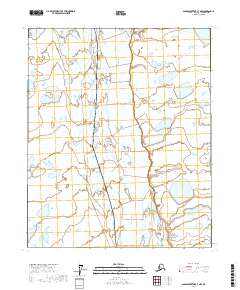
2017 Map of Sagavanirktok C-3 NW
USGS Topo · Published 2017About this map
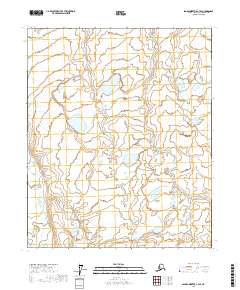
The Sagavanirktok River dominates this Arctic landscape, its braided channels and gravel bars cutting a wide path through the North Slope’s wetland tundra. This 2017 study illustrates the remote industrial infrastructure of the region, specifically the prominent route of the Alaska Pipeline as it parallels the river valley. The map details an environment defined by permafrost-patterned ground and numerous unnamed thermokarst lakes that dot the flat plains. This documentation provides a precise record of the corridor's topography and hydrological features during the early 21st century, showing how the massive energy transit line navigates the complex drainage systems of the Alaskan wilderness.
Find a feature on this map
8 named features on this map. Tap any name to fly to it.
Don’t see what you’re looking for? This feature index may not catch every label — zoom into the map to look around manually.
Map Details
Editions of this 2017 Sagavanirktok C-3 NW Map
This is the sole edition of this map. No revisions or reprints were ever made.
Other maps of this area

1951 · Sagavanirktok D-5
USGS Topo · 1:250,000

1955 · Sagavanirktok D-3
USGS Topo · 1:63,360

1955 · Sagavanirktok D-4
USGS Topo · 1:63,360

1956 · Sagavanirktok
USGS Topo · 1:250,000

1958 · Sagavanirktok
USGS Topo · 1:250,000

1964 · Sagavanirktok
USGS Topo · 1:250,000
1971 · Sagavanirktok C-3
USGS Topo · 1:63,360
1971 · Sagavanirktok C-4
USGS Topo · 1:63,360
2017 · Sagavanirktok D-3 SW
USGS Topo · 1:25,000
2017 · Sagavanirktok C-3 SE
USGS Topo · 1:25,000