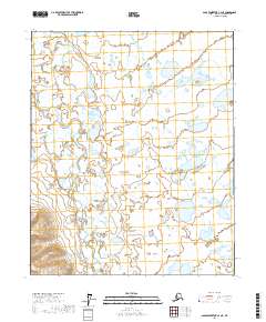
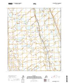
2017 Map of Sagavanirktok C-4 NE
USGS Topo · Published 2017About this map
Toolik River meanders across this Arctic landscape, creating a complex network of wetlands and small water bodies characteristic of the North Slope. This 2017 study illustrates the delicate hydrology of the tundra, where shifting stream channels and seasonal drainage patterns are clearly defined by the Usgs data. The map is primarily dominated by township and range boundaries, including t4n r13e and t3n r13e, which provide the legal framework for this remote region. This document serves as a detailed record of the environmental state of the North Slope in the early twenty-first century, useful for understanding the unchanged character of the Alaskan interior before any further infrastructure development.
Find a feature on this map
9 named features on this map. Tap any name to fly to it.
Don’t see what you’re looking for? This feature index may not catch every label — zoom into the map to look around manually.
Map Details
Editions of this 2017 Sagavanirktok C-4 NE Map
This is the sole edition of this map. No revisions or reprints were ever made.
Other maps of this area

1951 · Sagavanirktok D-5
USGS Topo · 1:250,000

1955 · Sagavanirktok D-3
USGS Topo · 1:63,360

1955 · Sagavanirktok D-4
USGS Topo · 1:63,360

1956 · Sagavanirktok
USGS Topo · 1:250,000

1958 · Sagavanirktok
USGS Topo · 1:250,000

1964 · Sagavanirktok
USGS Topo · 1:250,000
1971 · Sagavanirktok C-3
USGS Topo · 1:63,360
1971 · Sagavanirktok C-4
USGS Topo · 1:63,360
2017 · Sagavanirktok D-3 SW
USGS Topo · 1:25,000
2017 · Sagavanirktok C-3 SW
USGS Topo · 1:25,000