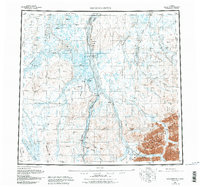
1958 Map of Sagavanirktok
USGS Topo · Published 1984About this map
The Sagavanirktok River serves as the central artery for this mid-century survey of Alaska's North Slope, a landscape undergoing significant industrial change. The map documents the early infrastructure of the region's energy corridor, featuring the Dalton Highway and the Trans-Alaska Pipeline running parallel to the river. Remote outposts like Sagwon and Gilead appear alongside specialized aviation markers such as the Franklin Bluffs Landing Strip and Happy Valley Landing Strip. To the east, the boundary of the Arctic National Wildlife Refuge encompasses the rugged White Hills and the Ivishak River drainage. This period of mapping is characterized by the coexistence of traditional winter routes, like the Winter Trail, and the modern industrial installations of oil and gas wells that began to define the North Slope's economic geography.
Find a feature on this map
37 named features on this map. Tap any name to fly to it.
Don’t see what you’re looking for? This feature index may not catch every label — zoom into the map to look around manually.
Map Details
Editions of this 1958 Sagavanirktok Map
4 editions found

Other maps of this area

1951 · Harrison Bay
USGS Topo · 1:250,000

1951 · Beechey Point
USGS Topo · 1:250,000

1951 · Sagavanirktok D-5
USGS Topo · 1:250,000

1951 · Chandler Lake
USGS Topo · 1:250,000

1951 · Brooks
USGS Topo · 1:250,000

1951 · Arctic
USGS Topo · 1:250,000

1951 · Mt. Michelson
USGS Topo · 1:250,000

1952 · Umiat
USGS Topo · 1:250,000

1955 · Flaxman Island
USGS Topo · 1:250,000

1955 · Harrison Bay
USGS Topo · 1:250,000