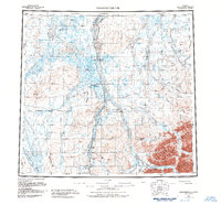
1958 Map of Sagavanirktok
USGS Topo · Published 1984About this map
The Sagavanirktok River dominates this landscape, serving as a corridor for industrial development across the North Slope. Parallel to the river, the Trans-Alaska Pipeline and the Dalton Highway demonstrate the mid-20th-century infrastructure expansion required for Arctic energy extraction. These modern routes contrast with the numerous instances of a Winter Trail, reflecting older patterns of seasonal travel across the tundra. Pockets of habitation and support appear at Franklin Bluffs and several remote airfields, including the Happy Valley Landing Strip and Sagwon Landing Strip. To the east, the terrain becomes more varied as it enters the Arctic National Wildlife Refuge, where the Ivishak River flows near the Ivishak Hot Springs and through the high ground of Niviak Pass.
Find a feature on this map
30 named features on this map. Tap any name to fly to it.
Don’t see what you’re looking for? This feature index may not catch every label — zoom into the map to look around manually.
Map Details
Editions of this 1958 Sagavanirktok Map
4 editions found

Other maps of this area

1951 · Harrison Bay
USGS Topo · 1:250,000

1951 · Beechey Point
USGS Topo · 1:250,000

1951 · Sagavanirktok D-5
USGS Topo · 1:250,000

1951 · Chandler Lake
USGS Topo · 1:250,000

1951 · Brooks
USGS Topo · 1:250,000

1951 · Arctic
USGS Topo · 1:250,000

1951 · Mt. Michelson
USGS Topo · 1:250,000

1952 · Umiat
USGS Topo · 1:250,000

1955 · Flaxman Island
USGS Topo · 1:250,000

1955 · Harrison Bay
USGS Topo · 1:250,000