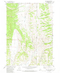
1980 Map of Sage Valley
USGS Topo · Published 1980About this map
Buck Mountain stands as a prominent landmark on this high-country landscape straddling the Caribou County and Lincoln County line along the Idaho-Wyoming border. This 1980 survey reveals a backcountry defined by grazing and travel routes, evidenced by landmarks like the Alkali Flat, various Springs, and a Corral north of Tygee Creek. The map shows the intersection of the Caribou National Forest and the Bridger Teton National Forest, where the terrain is carved by Smoky Canyon and Pole Canyon.
Find a feature on this map
31 named features on this map. Tap any name to fly to it.
Don’t see what you’re looking for? This feature index may not catch every label — zoom into the map to look around manually.
Map Details
Editions of this 1980 Sage Valley Map
2 editions found
Other maps of this area

1915 · Freedom
USGS Topo · 1:62,500

1915 · Crow Creek
USGS Topo · 1:62,500

1921 · Afton
USGS Topo · 1:125,000

1949 · Stewart Flat
USGS Topo · 1:24,000

1949 · Snowdrift Mountain
USGS Topo · 1:24,000

1951 · Stewart Flat
USGS Topo · 1:24,000
1951 · Snowdrift Mountain
USGS Topo · 1:24,000

1955 · Preston
USGS Topo · 1:250,000

1958 · Preston
USGS Topo · 1:250,000

1962 · Preston
USGS Topo · 1:250,000