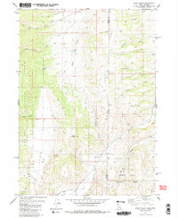
1980 Map of Sage Valley
USGS Topo · Published 1980About this map
Sage Valley sits at the intersection of the Idaho-Wyoming state line, defined by a landscape of high ridges and winding creek beds in the early 1980s. The terrain is dominated by the steep ascent of Caribou Ridge and the prominent Buck Mountain, while the valleys below are carved by waterways like Tygee Creek and Crow Creek. This map documents a region characterized by specialized land use, where remote jeep trails and the Tygee Trail provide the primary access to high-country resources.
Find a feature on this map
31 named features on this map. Tap any name to fly to it.
Don’t see what you’re looking for? This feature index may not catch every label — zoom into the map to look around manually.
Map Details
Editions of this 1980 Sage Valley Map
2 editions found
Other maps of this area

1915 · Freedom
USGS Topo · 1:62,500

1915 · Crow Creek
USGS Topo · 1:62,500

1921 · Afton
USGS Topo · 1:125,000

1949 · Stewart Flat
USGS Topo · 1:24,000

1949 · Snowdrift Mountain
USGS Topo · 1:24,000

1951 · Stewart Flat
USGS Topo · 1:24,000
1951 · Snowdrift Mountain
USGS Topo · 1:24,000

1955 · Preston
USGS Topo · 1:250,000

1958 · Preston
USGS Topo · 1:250,000

1962 · Preston
USGS Topo · 1:250,000