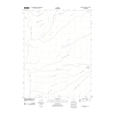
2010 Map of Sagebrush Hill
USGS Topo · Published 2010About this map
Beard Cow Camp anchors the northern high ground of this western Colorado survey, where the dramatic Cathedral Bluffs fall away into a complex drainage system. The landscape is defined by long, descriptive ridges such as Calamity Ridge, Dead Horse Ridge, and Airplane Ridge, reflecting a history of ranching and navigation across difficult terrain. Water management is a central theme in this arid environment, evidenced by the Blowdown Water Storage Dam and several vital watering points like Cottonwood Spring and Maverick Spring. A network of unpaved arteries, including County Rd-103 and County Rd-24, connect these remote features, while named drainages like Big Duck Creek and Dry Fork Corral Gulch carve out the topography beneath Sagebrush Hill.
Find a feature on this map
25 named features on this map. Tap any name to fly to it.
Don’t see what you’re looking for? This feature index may not catch every label — zoom into the map to look around manually.
Map Details
Editions of this 2010 Sagebrush Hill Map
This is the sole edition of this map. No revisions or reprints were ever made.
Other maps of this area

1907 · Rangely
USGS Topo · 1:125,000

1907 · White River
USGS Topo · 1:125,000

1910 · White River
USGS Topo · 1:125,000

1910 · Rangely
USGS Topo · 1:125,000

1952 · Wolf Ridge
USGS Topo · 1:24,000

1952 · Yankee Gulch
USGS Topo · 1:24,000

1954 · Vernal
USGS Topo · 1:250,000

1956 · Grand Junction
USGS Topo · 1:250,000

1958 · Vernal
USGS Topo · 1:250,000

1959 · Grand Junction
USGS Topo · 1:250,000