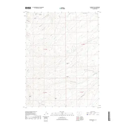
2019 Map of Sagebrush Hill
USGS Topo · Published 2019About this map
Cathedral Bluffs anchors the southwestern edge of this landscape, overlooking a series of deeply eroded ridges and drainages within the Piceance Basin. The terrain is characterized by high-elevation landforms like Calamity Ridge and Dead Horse Ridge, which separate a complex network of seasonal watercourses. Vital water sources are scattered throughout this high-desert environment, including Lem Springs, Cottonwood Spring, and Maverick Spring. These points would have been essential for cattle ranching or early survey expeditions across the high plateaus. A system of county roads, such as Co RD 80 and Co RD 103, provides access to the remote gulches like Big Duck Cr and Spruce Gulch. The map illustrates the specialized nomenclature of Western landforms, identifying distinct topographical features like The Shoulder and Airplane Ridge that define this high Rio Blanco County territory.
Find a feature on this map
30 named features on this map. Tap any name to fly to it.
Don’t see what you’re looking for? This feature index may not catch every label — zoom into the map to look around manually.
Map Details
Editions of this 2019 Sagebrush Hill Map
This is the sole edition of this map. No revisions or reprints were ever made.
Other maps of this area

1907 · Rangely
USGS Topo · 1:125,000

1907 · White River
USGS Topo · 1:125,000

1910 · White River
USGS Topo · 1:125,000

1910 · Rangely
USGS Topo · 1:125,000

1952 · Wolf Ridge
USGS Topo · 1:24,000

1952 · Yankee Gulch
USGS Topo · 1:24,000

1954 · Vernal
USGS Topo · 1:250,000

1956 · Grand Junction
USGS Topo · 1:250,000

1958 · Vernal
USGS Topo · 1:250,000

1959 · Grand Junction
USGS Topo · 1:250,000