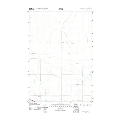
2011 Map of Sagebrush Ridge
USGS Topo · Published 2011About this map
Sagebrush Ridge dominates the eastern horizon of this Yakima County landscape, where the high desert terrain meets the organized grid of Washington's agricultural interior. The elevation drop at The Gap provides a natural corridor for N Gap Rd, while Spring Creek meanders southward across the quadrangle, occasionally paralleled by modern thoroughfares. To the north, the Anderson Ranch stands as a focal point of rural land use at the intersection of Nw Anderson Rd and N Missimer Rd. In the southern reaches of the map, the hydraulic infrastructure of the West Grandview Lateral indicates the critical role of water management in sustaining local orchards and fields, with a dense network of family-named roads like N Griffin Rd and N Wilgus Rd defining the local geography.
Find a feature on this map
24 named features on this map. Tap any name to fly to it.
Don’t see what you’re looking for? This feature index may not catch every label — zoom into the map to look around manually.
Map Details
Editions of this 2011 Sagebrush Ridge Map
This is the sole edition of this map. No revisions or reprints were ever made.
Other maps of this area

1915 · Prosser
USGS Topo · 1:125,000

1917 · Prosser
USGS Topo · 1:125,000

1950 · Grandview
USGS Topo · 1:62,500

1951 · Grandview
USGS Topo · 1:62,500

1951 · Corral Canyon
USGS Topo · 1:62,500

1953 · Walla Walla
USGS Topo · 1:250,000

1958 · Walla Walla
USGS Topo · 1:250,000

1965 · Whitstran
USGS Topo · 1:62,500
1965 · Prosser
USGS Topo · 1:62,500
1965 · Prosser
USGS Topo · 1:24,000