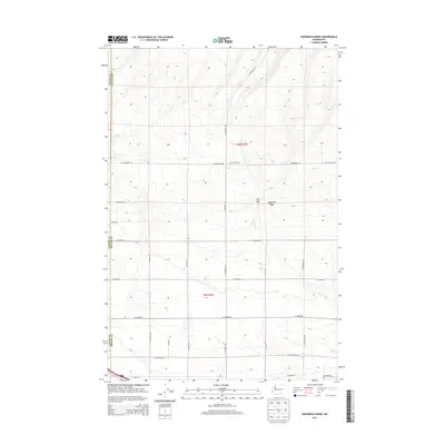
2013 Map of Sagebrush Ridge
USGS Topo · Published 2013About this map
Sagebrush Ridge and the surrounding high ground dominate the landscape of the Yakima and Benton county border in this 2013 survey. The area is defined by a grid of rural roads and agricultural development, with Anderson Ranch serving as a primary named landmark. The drainage of Spring Cr cuts through the terrain, passing through a notable geological feature known as The Gap. This region illustrates the intersection of modern road planning and natural topography, where major routes like N Missimer Rd and W Snipes Rd navigate the undulating contours. To the south, the terrain levels into more dense sections of township and range divisions, marked by numerous family-named roads including Mcpherson Ln and N Hinzerling Rd.
Find a feature on this map
24 named features on this map. Tap any name to fly to it.
Don’t see what you’re looking for? This feature index may not catch every label — zoom into the map to look around manually.
Map Details
Editions of this 2013 Sagebrush Ridge Map
This is the sole edition of this map. No revisions or reprints were ever made.
Other maps of this area

1915 · Prosser
USGS Topo · 1:125,000

1917 · Prosser
USGS Topo · 1:125,000

1950 · Grandview
USGS Topo · 1:62,500

1951 · Grandview
USGS Topo · 1:62,500

1951 · Corral Canyon
USGS Topo · 1:62,500

1953 · Walla Walla
USGS Topo · 1:250,000

1958 · Walla Walla
USGS Topo · 1:250,000

1965 · Whitstran
USGS Topo · 1:62,500
1965 · Prosser
USGS Topo · 1:62,500
1965 · Prosser
USGS Topo · 1:24,000