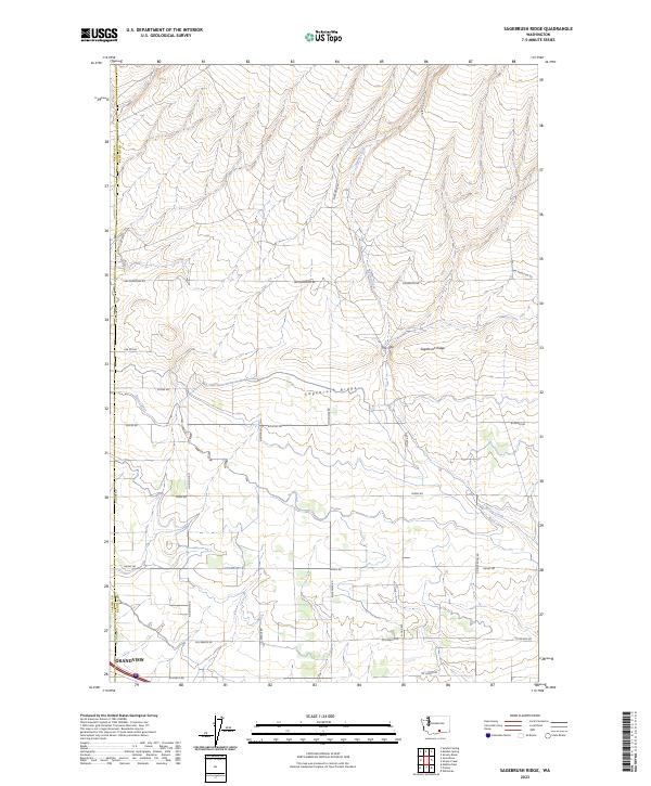
2023 Map of Sagebrush Ridge
USGS Topo · Published 2023About this map
Sagebrush Ridge forms a prominent topographical divider in this section of the Yakima Valley, where the dry highlands meet the irrigated agricultural lands of the south. The map documents the northern edge of Grandview, situated along the Yakima and Benton County line. This area is defined by its transition from the natural terrain of The Gap to the engineered water systems essential for regional farming, most notably the Roza Canal. The canal winds through the landscape, feeding a grid of rural roads and homesteads. Local routes such as Snipes Rd, Hanks Rd, and McCreadie Rd define the local township structure, while Spring Creek drains the northern slopes. The intricate layout of section lines and access roads like N Missimer Rd reflects the systematic development of this productive agricultural corridor.
Find a feature on this map
26 named features on this map. Tap any name to fly to it.
Don’t see what you’re looking for? This feature index may not catch every label — zoom into the map to look around manually.
Map Details
Editions of this 2023 Sagebrush Ridge Map
This is the sole edition of this map. No revisions or reprints were ever made.
Other maps of this area

1915 · Prosser
USGS Topo · 1:125,000

1917 · Prosser
USGS Topo · 1:125,000

1950 · Grandview
USGS Topo · 1:62,500

1951 · Grandview
USGS Topo · 1:62,500

1951 · Corral Canyon
USGS Topo · 1:62,500

1953 · Walla Walla
USGS Topo · 1:250,000

1958 · Walla Walla
USGS Topo · 1:250,000

1965 · Whitstran
USGS Topo · 1:62,500
1965 · Prosser
USGS Topo · 1:62,500
1965 · Prosser
USGS Topo · 1:24,000