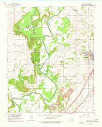
1963 Map of Sageeyah
USGS Topo · Published 1977About this map
The Verdigris River and its confluence with the Caney River dominate this 1960s landscape in Rogers County, shortly before regional water management projects further altered the river valley. The western edge of Claremore shows the early presence of the Oklahoma Military Academy and the local Fairground, marking the city's growth along the St Louis-San Francisco and Missouri Pacific railroad lines. To the west, the village of Keetonville sits near a prominent ridge, while the settlement of Sageeyah anchors the northern reaches of the quadrangle. The map reveals a diversified local economy where agricultural land sits adjacent to active Oil Wells, an Oil Field in Hickory Hollow, and numerous Gravel Pits. Local social life is indexed by rural institutions such as Lone Elm Ch, Lone Elm Sch, and the Chambers Cem.
Find a feature on this map
31 named features on this map. Tap any name to fly to it.
Don’t see what you’re looking for? This feature index may not catch every label — zoom into the map to look around manually.
Map Details
Editions of this 1963 Sageeyah Map
3 editions found
Other maps of this area

1901 · Claremore
USGS Topo · 1:125,000

1914 · Claremore
USGS Topo · 1:125,000

1916 · Claremore
USGS Topo · 1:125,000

1954 · Tulsa
USGS Topo · 1:250,000

1955 · Mingo
USGS Topo · 1:24,000

1956 · Collinsville
USGS Topo · 1:24,000

1958 · Tulsa
USGS Topo · 1:250,000

1959 · Collinsville NE
USGS Topo · 1:24,000

1963 · Tulsa
USGS Topo · 1:250,000
1963 · Sageeyah
USGS Topo · 1:24,000