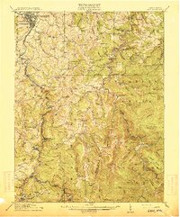
1914 Map of Sago
USGS Topo · Published 1914About this map
Buckhannon and its southern suburbs anchor this 1914 portrait of the West Virginia highlands, where a dense network of mountain railroads supported a burgeoning timber and coal economy. The B & O RR and Coal and Coke Ry trace the winding course of the Buckhannon River, serving established settlements like Sago and Tenerton. Deeper into the hills, the Alexander and Rich Mountain RR penetrates the drainage of the Middle Fork River, reaching industrial outposts like Alexander and the aptly named Chemical.
Find a feature on this map
123 named features on this map. Tap any name to fly to it.
Don’t see what you’re looking for? This feature index may not catch every label — zoom into the map to look around manually.
Map Details
Editions of this 1914 Sago Map
4 editions found

Other maps of this area

1886 · St. George
USGS Topo · 1:125,000

1889 · Beverly
USGS Topo · 1:125,000

1891 · St. George
USGS Topo · 1:125,000

1892 · Beverly
USGS Topo · 1:125,000

1893 · Buckhannon
USGS Topo · 1:125,000

1896 · Buckhannon
USGS Topo · 1:125,000

1897 · Buckhannon
USGS Topo · 1:125,000

1904 · Philippi
USGS Topo · 1:62,500

1904 · Weston
USGS Topo · 1:62,500

1907 · Belington
USGS Topo · 1:62,500