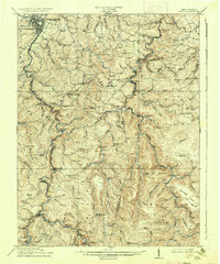
1914 Map of Sago
USGS Topo · Published 1937About this map
Buckhannon serves as the primary urban hub in this early 20th-century survey of the West Virginia highlands, where the Buckhannon River carves a winding path through the borderlands of Upshur, Randolph, and Barbour counties. The landscape is defined by a dense network of mountain communities and rural institutions, evidenced by the sheer number of schools like Mt Zion School and Hanging Rock School that served isolated hollows. Industrial activity is centered on the river corridors, with the Baltimore and Ohio and Western Maryland RR lines facilitating timber and resource extraction at sites such as Chemical and Sago.
Find a feature on this map
121 named features on this map. Tap any name to fly to it.
Don’t see what you’re looking for? This feature index may not catch every label — zoom into the map to look around manually.
Map Details
Editions of this 1914 Sago Map
4 editions found

Other maps of this area

1886 · St. George
USGS Topo · 1:125,000

1889 · Beverly
USGS Topo · 1:125,000

1891 · St. George
USGS Topo · 1:125,000

1892 · Beverly
USGS Topo · 1:125,000

1893 · Buckhannon
USGS Topo · 1:125,000

1896 · Buckhannon
USGS Topo · 1:125,000

1897 · Buckhannon
USGS Topo · 1:125,000

1904 · Philippi
USGS Topo · 1:62,500

1904 · Weston
USGS Topo · 1:62,500

1907 · Belington
USGS Topo · 1:62,500