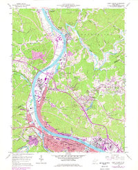
1958 Map of Saint Albans
USGS Topo · Published 1978About this map
The Kanawha River and Coal River confluence anchors this West Virginia industrial and residential corridor during a period of post-war expansion. This topographic survey captures the heavy industrial footprint of Nitro and Saint Albans, where the Chesapeake and Ohio and Conrail lines facilitated a massive transport network. Beyond the riverfront, the landscape reveals the extensive extractive history of Putnam and Kanawha counties, evidenced by numerous Coal Strip Mines and a Quarry dotting the northern hills. Educational and social foundations are well-documented, from West Virginia State College at Institute to local landmarks like the Indian Mound and the Drive-in Theater. Smaller settlements like Raymond City and Poca maintain their distinct identities alongside emerging suburban developments such as Ordnance Park and Virginia Heights.
Find a feature on this map
74 named features on this map. Tap any name to fly to it.
Don’t see what you’re looking for? This feature index may not catch every label — zoom into the map to look around manually.
Map Details
Editions of this 1958 Saint Albans Map
4 editions found
Other maps of this area

1899 · Charleston
USGS Topo · 1:125,000

1906 · Kenna
USGS Topo · 1:62,500

1906 · Winfield
USGS Topo · 1:62,500

1907 · Kenna
USGS Topo · 1:62,500

1908 · Winfield
USGS Topo · 1:62,500

1909 · Charleston
USGS Topo · 1:62,500

1909 · Saint Albans
USGS Topo · 1:62,500

1931 · Saint Albans
USGS Topo · 1:62,500

1931 · Charleston
USGS Topo · 1:62,500

1933 · Saint Albans
USGS Topo · 1:62,500